
Project Highlight: Goornong Floodplain Study
An important project shaping the future of flood risk management in regional Victoria
Goornong Floodplain Study
Combining advanced flood modelling, climate projections, and community input, the study provides actionable insights that set a new benchmark for regional flood planning and resilience.
Flood Study, 2025-2026
Our client was City of Greater Bendigo
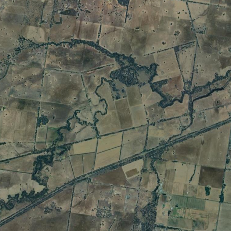
Google maps data ©2025 courtesy of Airbus, CNES/ Airbus, Maxar Technologies
Cumulus Engineering has been awarded the Goornong Floodplain Study, a significant and iconic project aimed at improving flood risk assessment and management in the region. This study is distinctive because it brings together advanced hydrologic and hydraulic modelling, climate change projections, and extensive community consultation to provide a comprehensive understanding of local flood behaviour.
Now underway, the project is progressing through key stages of data analysis, modelling, and engagement with stakeholders to ensure robust and practical outcomes. More than just a technical exercise, the study will inform future planning, emergency response, and flood mitigation options, directly safeguarding the Goornong community and setting a new benchmark for regional floodplain studies. Scheduled for completion by mid-2026, this project represents a lasting investment in resilience and sustainable growth for the region.
The study will inform future planning, emergency response, and flood mitigation options, directly safeguarding the Goornong community.
The Study will cover Goornong township and surrounding areas including North Huntly, Bagshot, North Bagshot, Fosterville, Wellsford, Avonmore. It will include several creeks and waterways: Bendigo Creek, Crabhole Creek, Reedy Creek, Sandy Creek, Yankee Creek, Five Mile Creek, and Gunyah Creek.
Google maps data ©2025 courtesy of Airbus, CNES/ Airbus, Landsat / Copernicus, Maxar Technologies
Author

Sarah Hollis
Senior Engineer
Share
Contact us for expert flood risk advice
Tell us about your project and the challenges you face. We’ll work with you to find the most practical, effective solutions for your site.
